St. Louis ADA Self Evaluation and Transition Plan
St. Louis, Missouri
Client
- City of St. Louis, Board of Public Service
The City of St. Louis has roughly 1,600 miles of sidewalks, over 11,000 intersections and 182 City buildings. While the City has performed hundreds of ADA improvement projects over the last thirty years, these improvements are undertaken by dozens of City departments. One of the primary goals of the Transition Plan is to consolidate all past efforts and establish a prioritization system to help guide future improvements throughout the City.
The City has an existing robust GIS system and the Plan fully integrates into that system. By doing this, it will assist the City in identifying future projects as well as all inventoried work completed to allow the City to document all ADA improvements taking place throughout the City.
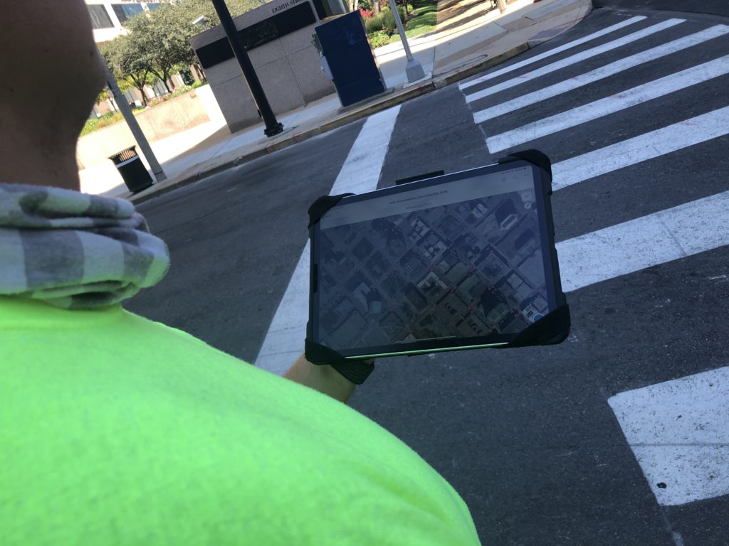
The City and Oates decided that the ideal methodology for inventorying the pedestrian assets under City jurisdiction was using iPads equipped with ArcGIS on-line. While there are several alternative methods varying from paper surveys to mobile surveying tools that document the physical condition of the sidewalk, this methodology was chosen by the City for many reasons. With this methodology, City staff have the flexibility to complete future assessments, they can collect all necessary data needed to determine compliance, and the City can update the system without having to reengage a consultant.
Due to the volume of data that will need to be collected to complete the self-inventory, the sidewalks, curb ramps and pedestrian traffic signals were prioritized based on their proximity to pedestrian traffic generators prior to starting data collection. Additionally, the prioritization system included socio-economic data made available by the Metropolitan Planning Organization to allow the project team to prioritize based on the residents living in the different neighborhoods throughout the City. This information allowed the City to assess high priority pedestrian assets early in the data collection process.
Our current work represents the first phase of a long-term plan to inventory the City. However, the framework used during this initial phase will help guide future efforts through the development of a city-wide prioritization map and establishing priorities for future data collection. The work ultimately completed by Oates Associates represents a small portion of the effort that will be required to complete the City’s final ADA Transition Plan. With a goal of the City having the ability to collect future assessments, detailed how-to guides will be created to assist the City in everything from collecting data to generating GIS maps of the prioritized pedestrian network. This enables the City to take full ownership of the Plan and execute their long-term vision.